
DATA-RECOVERY INVESTIGATIONS AND PUBLIC OUTREACH AT THE DIMOND KNOLL SITE (41HR796)
Jason W. Barrett
Richard A. Weinstein
Site 41HR796, also known as the Dimond Knoll site, is located approximately 14 miles northwest of the Houston city limits in northwestern Harris County, Texas. The site was represented primarily by a low sandy knoll formed atop a Pleistocene-age terrace of Cypress Creek, measuring approximately 20 meters north-south by 30 meters east-west, and measuring somewhat over one meter in height. This is one of many similar knolls that once flanked Cypress Creek for much of its length. The site was discovered in the early fall of 1996 by a team from Moore Archeological Consulting, Inc. (MAC) when they conducted the initial cultural resources survey on behalf of TxDOT for Segment E of the proposed route of SH 99, also known as Grand Parkway.
In October and November 2006, TxDOT sent a crew from PBS&J to revisit the site and conduct eligibility testing for the National Register of Historic Places (NRHP). Overall, the testing data indicated a robust Late Archaic occupation, possibly beginning ca. 2500 B.C., and an equally well represented Early Ceramic occupation during the first few centuries A.D. PBS&J concluded that the site was eligible for listing in the NRHP and that data-recovery investigations would be necessary if impacts could not be avoided during highway construction.
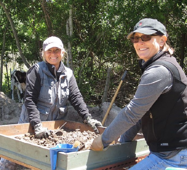
Two radiant ladies - HAS President Linda Gorski
and Lenore Psencik at the screens
The archeological investigations at Dimond Knoll have produced a wealth of important new data relating to prehistoric diet, resource use, technological transitions, and patterns of group mobility and interaction. While material analyses are presently in their incipient stages, a preliminary overview of findings suggests that the site was visited regularly by mobile foraging groups for nearly 10 millennia. Artifacts recovered within the upper 60 centimeters or so of the sandy mantle included both Late Prehistoric pottery and arrow points and Late Archaic dart points. The next 40 centimeters also contained Archaic material, but included items generally associated with both the Late and Middle Archaic periods. Particularly intriguing was the diversity in both arrow and dart point types identified throughout the sandy mantle deposit: Alba, Axtell, Catahoula, Perdiz, and Scallorn for the arrow points; Bulverde, Carrolton, Darl, Gary, Godley, Kent, Morhiss, Palmillas, Pedernales, Yarbrough, and possible Andice and Bell for the dart points.
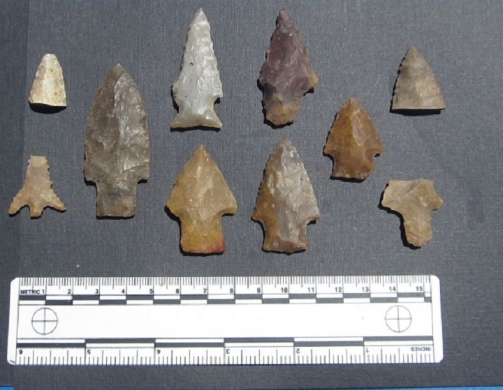
Examples of projectile points found during screening
Several pit features containing human remains were discovered during the course of data recovery excavations. Some contained only very poorly preserved bones that appeared to be human based on size, identifiable features, and context. Others had relatively well-preserved elements observed in an orientation indicative of flexed burials. Most of the burials are believed to date to the Late Prehistoric and later Archaic periods based on stratigraphic positioning within the sandy sediments of the mantle. However, the upper portion of one relatively large pit that contained the remains of three poorly preserved individuals appeared to be truncated and then capped by the upper paleosol, suggesting that it had been dug during either Early Archaic or Paleo-Indian times. This question, however, will remain unresolved. On December 11, 2012, TxDOT entered into a Memorandum of Agreement with Tribal groups, FHWA, and Texas SHPO to preserve each of the identified burials in place without exhumation. Thus, the remaining portions of the site, including each of the identified features containing human remains, were subsequently covered with a protective layer of sand and then covered with a cement cap in the presence of a tribal monitor. No artifacts were recovered from the pit features, and no analysis of the burials - including dating their sediment matrix - was completed.
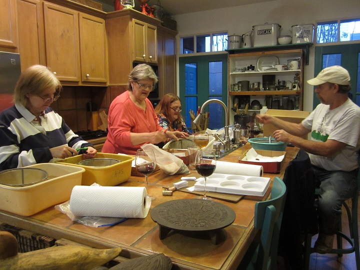
Beth Aucoin is centered among volunteer lab workers
enjoying their work and their wine!
Work and wine sounds mighty fine!
The TxDOT/HAS screening project has evolved into a tremendously successful public outreach effort under the direction of Dr. Barrett. Dozens of HAS members have signed up for the project since this effort began in early February 2013. Participants from the Brazosport and Fort Bend archeological societies have also joined the project, as well as anthropology/archeology students and professors from several local colleges including the University of Houston, St. Thomas University, Houston Community College and Lone Star College. The project has also been host to school groups from Rosehill Christian Academy and the Kincaid School, and will be joined by a group from the Houston Museum of Natural Science later this summer. The project has generated outstanding word-of-mouth communication, encouraging the participation of many people who have wanted to be archeologists since childhood but have never had the opportunity. All the artifacts recovered at the screening site will be cataloged, analyzed, curated, and reported along with those recovered in the hand-excavated sample from the site.
To learn more about this project contact the President: president@txhas.org